
Detailed service guide
137 services, 10 service areas. Search, filter and open a description.
No matching service found. Try another keyword or contact us.
Power transmission and telephone line dossier
The planned route, connection points and relationship to the terrain of a power transmission or telephone line are assessed using map data. Route information, field findings and project explanations are brought together to clearly present the areas crossed and the required use in the application. The output is a technical dossier setting out the forestry aspects of the line project.
View this service →Dossier for GSM and internet provider base stations, radio and television transmitter stations and antennas
The proposed site for a base station, transmitter or antenna is examined together with the facility layout, access requirements and surrounding forest structure. Location data, layout drawings and the technical explanations required from a forestry perspective are organised to present the project's land use in the application dossier. The dossier shows the facility's relationship to the forest area and the boundaries of the requested use.
View this service →Final permit application dossier for airports
The site boundaries, facility layout and technical data relating to forest areas required at the airport project's final permit stage are assessed together. Consistency between earlier studies and current project information is checked to prepare a dossier explaining the forestry component of the application. The output is an organised permit dossier showing the location and scope of the requested use through maps and technical explanations.
View this service →Preliminary permit application dossier for airports
The proposed airport site's location, terrain and relationship to forest areas are examined using initial project information. Available data are organised for those seeking to establish site selection and land use at the preliminary permit stage. The dossier explains the proposed area and intended use through maps, providing a technical framework for subsequent project work.
View this service →Communication board permit application dossier
The proposed location, dimensions and layout of the communication board are examined together with surrounding land use. Where the area requested for the board needs to be accurately defined in the application, a location map, site information and use explanations are organised. The permit dossier technically illustrates the proposed placement and its relationship to forest land, defining the boundaries of the use to be assessed.
View this service →Other permit application dossiers under Article 16
For other permit requests under Article 16, the nature of the activity and information about the proposed site are assessed together. Site boundaries, available data and the scope of the necessary technical work are established according to the application's purpose. Maps and technical explanations are organised into a permit dossier that defines the requested use as a whole.
View this service →Other permit application dossiers under Article 17
For other permit requests under Article 17, the project's purpose, layout and relationship to forest land are examined. Gaps in site data and project information are identified so that the use can be clearly presented in the application. The dossier brings together the requested area and activity through technical explanations, with its scope shaped by the specific project.
View this service →Other permit application dossiers under Article 18
For other permit requests under Article 18, the area required by the planned activity and existing land information form the basis of the work. Project information, map data and technical assessments are organised according to the application's purpose. An application dossier is prepared that explains the intended use, site boundaries and forestry aspects of the project together.
View this service →Archaeological excavation and restoration permit dossier
The location, work boundaries, access needs and relationship to forest land of an archaeological excavation or restoration project are examined using project data. Map information and technical explanations are organised to define the site to be used from a forestry perspective. The permit dossier shows the excavation or restoration work area and its land use, clearly presenting the application's site-related aspects.
View this service →Fish production facility permit dossier
The fish production facility's layout, proposed area and surrounding terrain are examined together with available project information. Location, boundary and technical use information are compiled to show the production area's relationship to forest land in the application. The permit dossier presents maps and technical data explaining the facility components and requested land use as an organised whole.
View this service →Dam and pond permit dossier
The reservoir area, facility layout and associated work areas of a dam or pond project are examined using existing maps and project data. Site information and technical explanations are prepared to accurately present the boundaries of uses affecting forest land in the application. The dossier includes maps and assessments showing the project's spatial scope and its relationship to forest areas.
View this service →Documentation for requests for opinions on licence applications in protection forests
Technical information on the location, area and proposed activity of a licence request within a protection forest is organised. Site characteristics and available information are brought together to support an informed review of the requested opinion. Maps and explanations identify the area and activity covered by the request, providing clear technical application documentation for the opinion process.
View this service →Permit application documentation for non-wood product processing facilities
The facility layout, use area and technical information relevant to a non-wood product processing permit request are assembled in an application file. Site boundaries and the scope of operations are presented consistently through maps, drawings and explanations. The deliverable is the permit application documentation; a feasibility report assessing the investment is treated as a separate service.
View this service →Permit documentation for wood-using production sites, including charcoal, turpentine, tar and tree gum
The location, operating approach and land requirements of a wood-using operation, such as charcoal, turpentine, tar or tree gum production, are examined. Technical explanations and spatial information establish the relationship between the production purpose and the site used. The permit application file presents the scope and layout of the requested activity in an organised form, providing a technical basis for assessing the land use.
View this service →Application documentation for the use of trees and shrubs on land not classified as forest
Information on the site, vegetation and proposed operations is organised for a request to use trees and shrubs on land not classified as forest. Necessary technical assessments and existing records are brought together for the application. Unlike an inspection report, the file focuses on presenting the request and explains which plants, area and type of use it covers.
View this service →Inspection of permitted sites under Article 16
Current use of a site permitted under Article 16 is examined against the permitted boundaries and activity information defined in the file. The inspection identifies how the implemented work can be traced through records and any differences that need technical explanation. Field observations, measurements and relevant drawings are assembled into technical inspection records specific to this permit scope.
View this service →Inspection of permitted sites under Article 17/3
The current condition of facilities or use areas on a site permitted under Article 17/3 is examined alongside the layout and boundaries defined in the relevant permit file. The work helps explain the on-site implementation and compare it with the records. Observations, required measurements and maps are organised to present condition findings and a technical inspection assessment of the use under this article.
View this service →Inspection of permitted sites under Article 18
The current boundaries, type of use and activities on a site permitted under Article 18 are assessed using the relevant file information. The relationship between observed site conditions and records is established to identify matters requiring explanation or follow-up. Maps, field records and assessments document the inspected site's condition specifically within this permit scope.
View this service →Permit documentation for solid waste disposal and sanitary landfill facilities
The area, layout and scope of use covered by a solid waste disposal or sanitary landfill permit request are examined together with project information. The spatial relationships between disposal sections, facility areas and associated uses are clarified for the application. Maps, drawings and relevant technical explanations present the site boundaries and facility arrangement to be assessed from a forestry perspective.
View this service →Port support area permit application documentation
The location, use boundaries and planned functions of a support area serving port operations are assessed technically. The layout of storage, access and other support uses is organised using project data. Maps, drawings and explanations present the scope of the requested use in relation to forest land and its connection to the port within a permit application file.
View this service →Mining infrastructure facility permit application documentation
The location, land requirements and connection to the mining operation of a supporting infrastructure facility are examined using existing project information. The facility layout and associated uses are organised to clarify the permit request boundaries. Unlike documentation for an exploration or production area itself, the deliverable focuses on infrastructure use and contains site maps, facility information and technical explanations for a forestry permit application.
View this service →Mineral exploration permit application documentation
The area for mineral exploration, proposed exploration methods and required on-site use areas are defined technically. Exploration project information is linked to site boundaries to explain which areas and operations the request covers. The permit application file presents maps, layout information and technical assessments focused on exploration needs, as distinct from the production stage.
View this service →Mining operation permit application documentation
The production area, planned site uses and operating layout of the mine are assessed using project information. Maps and technical explanations align the boundaries of the requested operating area with the associated uses. Unlike exploration documentation, the permit application file sets out the land requirements at the production stage and the mine's layout on the site.
View this service →Mining permits
The location, use boundaries and features requiring forestry assessment of an area proposed for mining are examined. Site information, maps and technical explanations are assembled to prepare permit documentation according to exploration or operating needs. The work provides a technical basis for an application that clearly sets out the requested area and scope of activities.
View this service →Mining facility permit application documentation
The layout, footprint and relationship to other uses on the site of facilities serving mining activities are assessed. Technical information explaining the facility needs, area boundaries and maps are organised to prepare the forestry component of the permit application. The resulting file shows where and to what extent facility use is planned, separately from the extraction area.
View this service →Cemetery Site Permit Documentation
The boundaries, access connections and existing land characteristics of the proposed cemetery site are assessed. The proposed layout and requested land-use area are incorporated into the permit documentation with maps and technical explanations. The work establishes the site and layout intended to meet the cemetery need, creating documentation that supports assessment of the application from a land-use perspective.
View this service →Documentation for Explosives Storage Safety Areas and Underground Storage Facilities
The proposed location and land-use boundaries of the storage facility, together with the layout of its associated safety area, are assessed. For underground storage facilities, site location information and land-use requirements are also addressed within the technical scope of the documentation. Maps and explanations present the requested area and the facility's land-use relationships for assessment of the application.
View this service →Oil Exploration and Production Permit Documentation
The site to be used for oil exploration or production, its working areas and the relationship between facilities and the land are examined. Exploration needs and the scope of production-related land use are considered separately, with locations, boundaries and activity descriptions organised in the documentation. The technical content makes the proposed use visible on maps and clearly explains the scope of the activity covered by the permit application.
View this service →Permit Documentation for Healthcare, Education, Sports, Correctional, Judicial, Defence and Security Facilities
The purpose, layout and land requirements of the proposed public service or facility use are assessed alongside relevant site characteristics. The area covered by the application is defined through technical explanations and maps according to its healthcare, education, sports, correctional, judicial, defence or security function. The permit documentation presents the facility's location and requested land-use boundaries as a clear and coherent whole.
View this service →Stray Animal Shelter Permit Documentation
The boundaries, access and arrangement of facility sections on the proposed shelter site are assessed. Areas intended for animal accommodation and care activities are incorporated into the documentation through maps and technical explanations in line with the project's overall needs. The work defines the shelter's requested land use and supports preparation of the permit application in terms of location and area coverage.
View this service →Drilling Permit Documentation
Proposed drilling points, working platforms and access requirements are examined alongside the site's land characteristics. The boundaries of the area to be used and the scope of drilling are defined in technical explanations according to the purpose of the work. The permit documentation maps the proposed land use and clearly identifies work locations and ancillary areas for assessment.
View this service →Route Documentation for Water Transmission, Wastewater and Natural Gas Pipelines and Roads
The proposed pipeline or road route is assessed in terms of land crossings, existing uses and the width needed for the work. Technical route descriptions and site boundaries are organised according to the requirements of the water, wastewater or natural gas pipeline, or road. Maps and explanations show where the linear project passes and the areas for which land use is requested.
View this service →Water Well and Water Borehole Permit Documentation
The selected water well or borehole location, working area and site access conditions are assessed. The land use requested for water supply is recorded in the documentation through maps and technical explanations relating to the well or drilling area. Unlike documentation for general drilling work, the deliverable defines the site use specifically required to obtain water.
View this service →Tree Felling Procedures on Land with Registered Title
The location, species and current condition of trees proposed for felling on titled land are assessed alongside property information. Site findings, measurements and technical records are prepared to help identify the relevant area and trees. The work supports documentation of the felling request with concrete data and connects site-specific tree information with the scope of the application.
View this service →
Drilling and access road permit dossier for energy projects
Drilling locations and access road routes associated with an energy project are examined using terrain conditions and available forest area data. For applications that need to clearly show the areas requested for drilling and site access, maps, layouts and technical explanations are organised into a permit dossier covering both uses.
View this service →Surplus excavation material disposal area project for hydropower plants (HES)
Project data on the quantity and characteristics of surplus material from hydropower works are assessed alongside the proposed disposal area's slope, access and environmental features. A site layout is prepared to plan where and how the material will be placed. The project explains the disposal arrangement and technical measures considered for surface water, slopes and the area's final use.
View this service →Revision dossier for hydro, solar, wind, biomass, geothermal, nuclear and thermal power plants (HES, GES, RES, BES, JES, NES and TES)
The energy facility's previous dossier is compared with changes to its layout, site boundaries, routes or project components. Where the application information needs to accurately reflect the new project configuration, the changes are incorporated into maps and technical explanations. The revision dossier brings together current project data by comparing the changed elements and their relationship to forest land use.
View this service →Hydroelectric power plant (HES)
The parts of a hydroelectric power plant project relating to forest areas are assessed using the site layout and available project data. Requested areas and project components are considered together to identify the investment's forestry work requirements. The scope of the technical work and dossier is determined according to the project stage and required service, and site information is organised accordingly.
View this service →Biomass power plant permit dossier
The biomass power plant's layout, facility components and requested work areas are examined in relation to forest land. Existing maps and technical project data are organised to define the plant project's land use in the permit application. The dossier clearly presents the facility location, use boundaries and site information considered from a forestry perspective.
View this service →Nuclear power plant permit application documentation
The nuclear power plant project's layout in relation to forest land, land requirements and sections covered by the permit application are examined technically. Project information and spatial data are combined to clarify the boundaries of the requested use. The deliverable is a permit application file containing maps, drawings and technical information that explain the area and facility layout to be assessed from a forestry perspective.
View this service →Solar power plant permit documentation for permitted areas, facility roofs and water surfaces
A proposed solar power installation on an already permitted area, facility roof or water surface is examined together with the existing use and site boundaries. Technical drawings and explanations clarify its footprint and relationship to the existing facility. The permit application file spatially defines the new use request, providing a basis for assessing the solar installation within the existing permitted area.
View this service →Geothermal power plant permit application documentation
The geothermal power plant's proposed layout, facility components and land requirements covered by the permit request are assessed using project data. Maps and technical explanations organise the location of the plant and associated uses and their relationship to forest land. The deliverable is a forestry permit application file that clearly presents the requested use boundaries and project layout on the site.
View this service →Final Permit Documentation for Wind Power Plants under a Preliminary Licence or Licence
Land use for turbine sites, connections and ancillary facilities is defined for a wind power project covered by a preliminary licence or licence. Existing project data are compared with site locations and boundaries to prepare technical documentation for the final permit application. The deliverable presents the requested land-use areas and facility components through consistent maps and explanations.
View this service →Preliminary Permit Documentation for Wind Power Plants
Proposed turbine zones, ancillary areas and connection requirements are considered alongside site conditions at the initial assessment stage of a wind power investment. The location and intended use of the area covered by the preliminary permit request are set out in maps and technical explanations. The documentation establishes the site's scope and current land requirements as a basis for the facility layout to be developed in greater detail.
View this service →Wind Measurement Mast Permit Documentation
The proposed mast location, access to it and the surrounding area needed for work are assessed. The land required for wind measurement is described in the permit documentation through location information and technical explanations. Separately from the overall power plant layout, this work defines the measurement facility's footprint and prepares documentation for assessment of land use intended for collecting wind data.
View this service →Final Permit Documentation for Thermal Power Plants (TES)
Facility layouts and the boundaries of the requested land-use areas are examined at the final permit stage of a thermal power project. Project data are compared with site information, and technical explanations for the plant and its associated ancillary uses are organised in the documentation. The content maps the detailed facility use and helps define the areas covered by the application consistently.
View this service →Preliminary Permit Documentation for Thermal Power Plants (TES)
The proposed site, initial facility layout information and land-use requirements are assessed at the preliminary permit stage of a thermal power investment. The location and intended use of the requested area are set out through maps and technical explanations. The preliminary permit documentation establishes the initial area coverage of the plant project, which will later be developed in greater detail, and provides a technical basis for site assessment.
View this service →
Tree survey plan and technical report for parks, gardens, cemeteries and roadside vegetation owned by municipalities, individuals and legal entities on registered plots subject to development
The species, locations, dimensions and observable condition of trees in parks, gardens, cemeteries or along roadsides on a registered plot are recorded. Inventory information is incorporated into the plot plan so that development or site arrangement decisions can take existing trees into account. The tree survey plan and technical report present each tree's location together with the inspection findings.
View this service →Pre-transplantation tree report for registered plots subject to development
Where a tree is being considered for relocation, its species, dimensions, visible health, root surroundings and current site conditions are examined; the proposed new location is also assessed. A pre-transplantation report is prepared for those seeking a technical basis for the relocation decision and preparatory work. The report explains the conditions affecting relocation, preparation needs and matters to consider during implementation.
View this service →Tree revision and transplantation report
Changes to an existing tree inventory or layout plan are examined together with the condition of trees being considered for relocation. Earlier and revised layout data are compared to assess the project revision's effects on trees and the need for transplantation. The report brings together updated tree information, site conditions relevant to relocation and recommended technical operations.
View this service →Technical tree assessment report
The species, location, basic dimensions and observable physical condition of trees within the study area are identified in the field. Where existing trees need to be documented for a plot, facility or site arrangement project, the findings are linked to photographs and field records. The technical report clearly shows which trees were examined and their identified characteristics, creating a record for subsequent decisions.
View this service →Tree survey plan
Tree locations are measured on site and linked to species and basic dimension data, making each tree identifiable on the plan. A tree survey plan is prepared for those seeking to incorporate existing trees into layout decisions for construction, landscaping or site arrangement works. The output is a measured plan and inventory showing the spatial relationships between trees and other features on the plot.
View this service →Acoustic tomography and tree failure risk analysis
Acoustic tomography measurements provide data on the tree trunk's internal structure; these are assessed alongside visible defects, the surroundings and areas that could be affected if the tree falls. A risk analysis provides a technical basis for safety and maintenance decisions. The report explains the measurement findings, assessment limitations and matters to consider for monitoring or intervention.
View this service →Monumental tree assessment record
Information is compiled on the location, species, dimensions, visible characteristics and surroundings of a tree being considered for monumental tree assessment. A record is prepared to identify the tree and document the features under evaluation. It brings together field observations, photographs and measurements to create a technical record specific to the tree.
View this service →Inspection and assessment reports on the use of trees and shrubs on land not classified as forest
The species, current condition and distribution of trees and shrubs on land not classified as forest are examined together with the proposed use. The assessment helps establish the relationship between the vegetation present and the requested intervention. Observations and technical opinions are documented in a site-specific inspection and assessment report for use in an application or decision-making process.
View this service →Post-transplantation technical reports for trees on titled plots subject to development
The location, current condition and care needs of trees transplanted on a titled plot subject to development are assessed on site. Observed development, potential problems and matters requiring follow-up after relocation are recorded technically. The report documents the transplanted trees' condition at a specific date and provides site-specific recommendations for subsequent care and monitoring.
View this service →
Rehabilitation project for former mining sites
The landform left after mining, surface and soil conditions, vegetation and surrounding natural environment are examined. Appropriate intervention areas and an implementation approach are identified to revegetate the site and improve its land functions. The rehabilitation project presents site-specific technical decisions on land shaping, species selection, maintenance and monitoring.
View this service →Energy forest project for biomass production
Site conditions, soil and terrain, suitable species and the production approach are assessed for the area intended for biomass production. Technical decisions on establishment, tending and the production cycle are developed for those planning woody biomass production for energy. The project shows a suitable site layout and implementation steps, addressing production targets and maintenance needs together.
View this service →Rehabilitation and improvement project for degraded forest areas
The degraded forest area's existing tree structure, openings, natural regeneration and growing conditions are examined. Needs for supporting natural development, tending or supplementary establishment work are identified to strengthen the forest structure. The rehabilitation and improvement project defines intervention areas and suitable practices, creating a technical work programme for improving the site.
View this service →Plans and projects for establishing forest ecosystems
The soil, climate, topography and existing vegetation of the area intended for a forest ecosystem are examined. A planting, site preparation and tending approach is developed with regard to relationships between species and their growing environment. Beyond individual planting operations, the plan and project provide a technical framework explaining the measures and spatial arrangements that will guide the area's ecological development.
View this service →Phased closure plans
Current use, sections to be closed and the site's intended subsequent condition are examined where an activity is planned to end in stages. Closure operations are coordinated with land reshaping and vegetation improvement needs according to site characteristics. By showing which tasks are to be carried out in each section and in what order, the plan creates a traceable and technically coherent closure programme.
View this service →Energy Forest Establishment Projects for Existing Degraded Coppice Forests
Existing vegetation, coppice regrowth and the productive potential of the growing conditions are assessed in degraded coppice areas. An approach to tending, renewal and site preparation is developed around the objective of producing wood for energy. The establishment project provides a technical roadmap for production work by identifying interventions and their locations while taking the existing forest structure into account.
View this service →Private Afforestation Projects
Soil, slope, climate and existing vegetation are assessed on the proposed private afforestation site to identify options suited to its growing conditions. Tree species selection, site preparation, planting layout and tending arrangements are developed alongside the intended land-use objective. The project identifies planting areas and technical works, providing a structured approach to establishing new tree cover.
View this service →Revisions to Private Afforestation, Erosion Control and Forest Restoration Projects
Existing project decisions are compared with current site conditions to identify practices that need to change. Species and planting arrangements for afforestation, protective measures for erosion control, and improvements to existing vegetation for forest restoration are considered within their respective objectives. The revision incorporates the necessary changes into maps and project explanations to produce an updated technical project suitable for implementation.
View this service →Implementation Projects for Private Forest Restoration and Erosion Control
Existing vegetation, surface runoff and areas vulnerable to soil loss are examined to identify improvement needs. Appropriate site measures are planned to enhance existing vegetation through forest restoration and to protect soil through erosion control. The implementation project defines the fieldwork by showing interventions for both objectives, their locations and the relevant technical explanations.
View this service →Site Potential Assessment, Mapping and Reports for Previously Unassessed Areas
Terrain, vegetation and growing conditions are examined in areas that have not previously undergone a site potential assessment. Sections suitable for the intended purpose and site characteristics affecting the assessment are identified and mapped. The report explains the technical reasoning behind these findings, providing a site assessment that forms a basis for subsequent afforestation or improvement project decisions.
View this service →Rehabilitation Projects under Articles 12 and 13 of the Regulation
Existing vegetation, terrain conditions and areas requiring improvement are assessed on sites in need of rehabilitation. Suitable interventions are designed after clarifying the regulation applicable to the application and the scope of work under the referenced Articles 12 and 13. The technical deliverable is a rehabilitation project showing the proposed site improvements, their locations and the reasons for selecting them.
View this service →Rehabilitation Project Revisions
The existing rehabilitation project is reviewed against site changes and needs that have emerged during implementation. Improvement methods, intervention areas and working arrangements requiring updates are identified with their technical justification. The revised project connects the original objective with current site conditions and incorporates changed practices into maps and explanations, supporting subsequent work under the updated conditions.
View this service →Field-Edge and Roadside Tree Planting Projects
The width, soil characteristics and relationship to surrounding uses of the proposed field-edge or roadside planting strip are assessed. Tree species, planting distances and tending arrangements are planned according to the area's function and transport or agricultural needs. The project shows the linear planting layout and provides technical descriptions of the planting sections and initial tending work.
View this service →Fire-Resilient Forest Establishment Projects
Vegetation, fuel structure, terrain characteristics and continuity within the forest are assessed from a fire perspective. Tree species selection, stand arrangements and vegetation management measures are planned with the aim of improving fire resilience. The project provides technical direction for establishment and tending by identifying forest design decisions and site arrangements that can contribute to reducing fire risk.
View this service →
Young forest stand tending project
The species composition, distribution and development of young forest regeneration, along with surrounding competition, are assessed in the field. Intervention needs are identified for those seeking to support young tree growth and plan tending work in the appropriate areas. The project sets out the sections to be treated, the operations to be undertaken and the development indicators to be monitored afterwards.
View this service →Forest soil surveys, analysis, improvement and site quality assessment
Forest soil structure, depth, water retention and conditions affecting plant growth are evaluated through field surveys and appropriate analyses. Site quality, reflecting the productive capacity of the growing environment, is assessed alongside relevant field and stand data, while soil problems and improvement needs are identified. The results are presented as technical assessments and improvement recommendations to support species selection and tending decisions.
View this service →Planning forest fire access roads and firebreaks
The forest area's topography, vegetation, existing access network and fire response needs are assessed together. The locations of fire access roads and firebreaks are planned with regard to site characteristics and access and maintenance requirements. The plan shows proposed routes, firebreak arrangements and implementation details, providing a basis for fire prevention and response preparation.
View this service →Forest site analysis, inventory and mapping
The growing conditions that influence forest development, including climate, topography, soil and vegetation, are examined together. Areas with similar conditions are identified through inventory work and mapped spatially. The resulting analysis, inventory and maps describe the site's different sections, ecological features and growing conditions for use in afforestation, tending or forest management decisions.
View this service →Non-wood plant product inventories
The species, distribution, available quantities and key use-related characteristics of non-wood plant products on the site are identified. The inventory shows which products occur where and how the site's potential is distributed, supporting planning needs. The data are compiled into an inventory comprising product and site records, tables and maps where needed.
View this service →Implementation projects for non-wood plant products
The intended use of non-wood plant products is assessed in relation to product characteristics and the site's existing potential. The locations, methods and sequence of collection, production or tending work are planned with resource continuity in mind. The implementation project explains the scope and technical approach of on-site work, helping turn inventory information into a practical work programme.
View this service →Feasibility reports for non-wood product processing facilities
Raw material supply, production approach, capacity needs and key investment elements of a non-wood product processing facility are assessed together. Technical and economic feasibility is examined using available data and clearly stated assumptions. The feasibility report identifies alternatives and resource requirements, helping explain the project's strengths and uncertainties before an investment decision is made.
View this service →Technical reports for non-wood product processing facilities
The production method, capacity, layout and raw material requirements of a non-wood product processing facility are examined technically. The assessment clarifies how the facility is intended to operate and identifies the project's main technical needs. The report clearly presents the process, land use and facility characteristics, providing a facility-specific engineering assessment for planning or documentation work.
View this service →Digitisation of forest management plans
Maps, tables and other data from existing forest management plans are converted into a structure suitable for digital use. Data consistency is checked while preserving the relationships between spatial information and associated records. The digitised output provides an organised planning dataset that makes it easier to query areas, update data and use plan information in mapping or management work.
View this service →Restoration projects for detailed tree care in forest vegetation
Forest trees and other relevant plants requiring care are assessed in detail for their current condition and development problems. A care and improvement approach suited to each plant is established, with the scope and sequence of interventions explained. The restoration project turns work to conserve and improve the vegetation into a technical programme that can be followed on site.
View this service →Surveys, plans and projects for establishing forest genetic conservation areas
Species, tree populations, growing conditions and conservation needs are assessed on the proposed forest genetic conservation site. Site selection and the management approach for conserving genetic resources are linked to survey findings. The plan and project explain the selected area's boundaries, vegetation to be protected and proposed measures, establishing a technical basis for creating the conservation area.
View this service →Rural development planning and implementation projects
Natural resources, existing production opportunities and local needs in a rural area are assessed within the intended development initiative. A practical approach is developed by coordinating the proposed activities' land use, technical requirements and implementation sequence. The plan and implementation project provide a concrete roadmap explaining how resources are to be used and how the work is proposed to proceed.
View this service →Young plantation tending projects
The development of a newly established forest plantation or afforestation site, the condition of seedlings and tending needs are assessed. The scope and sequence of weeding, soil cultivation or similar tending operations are determined according to site conditions. The project explains area-specific interventions to support young plant growth, creating a technical work programme that tending teams can follow.
View this service →Grazing Plans for Forests, Pastures, Summer Pastures and Winter Grazing Areas
Vegetation, forage resources, terrain and grazing pressure are examined together. Grazing zones, periods and resting arrangements are planned with consideration for how livestock use the area and the need to protect its vegetation. The resulting plan sets out a land-use arrangement and technical principles suited to the characteristics of the forest, pasture, summer pasture or winter grazing area.
View this service →Forest Management Plans for Private Afforestation and Restoration Areas
The existing structure and development of tree cover, together with management objectives, are assessed in private afforestation and forest restoration areas. Tending, cultivation and resource-use decisions are organised for each part of the site with regard to its development over time. The forest management plan addresses management needs after initial establishment and sets out the purposes and technical principles governing the area.
View this service →Road Network Plans for Private Forests
The private forest's terrain, existing roads and access points needed for tending, production or protection work are assessed. Road routes are planned as an interconnected access network, taking slope and the integrity of the site into account. The road network plan maps existing and proposed connections, providing a technical framework for access to work areas within the forest.
View this service →Forest Management Plans for Private Forests
Tree species, stand structure, development and land-use objectives in the private forest are examined using field data. Tending, regeneration, protection and resource-use decisions for different parts of the forest are considered within a long-term management framework. The forest management plan sets out the current condition of resources and proposed interventions, helping the owner organise management work into a technical programme.
View this service →Young Stand Tending Projects
Tree distribution, competition and development in young forest areas are examined to identify tending needs. Intervention areas and a tending approach that supports future stand structure are planned according to site characteristics. The young stand tending project provides a practical framework for this work by setting out the development pattern to be maintained and the technical principles to be applied.
View this service →Silvicultural Plans
The forest's species composition, age and development structure, growing conditions and management objectives are assessed together. Interventions for stand cultivation, tending and renewal are organised in a technical sequence according to the needs of each section. The silvicultural plan covers more than a single tending operation, setting out the practices that will guide forest development and their distribution across the site.
View this service →Artificial Forest Regeneration Projects
The existing stand, soil and growing conditions are assessed where a new forest generation is to be established through planting or sowing. Species selection, site preparation, establishment methods and initial tending needs are determined alongside the regeneration objective. The project identifies implementation areas and technical working arrangements for establishing new tree stands by artificial means in place of, or in support of, natural regeneration.
View this service →
Interpretation of aerial photographs and satellite imagery and integration into existing maps
Aerial photographs and satellite imagery are examined for vegetation, land use, site boundaries or changes over time. Where the visual data need to be used with existing maps, the interpreted features are incorporated as appropriate layers. The work produces map data and explanations suited to the assessment purpose, taking account of the imagery's date and resolution limitations.
View this service →Completion dossier for areas announced, finalised and registered under Law No. 3402
Existing cadastral information, maps and file records for areas announced, finalised and registered under Law No. 3402 are compared. Boundary, plot and record relationships are examined to consistently assemble the data needed for the completion work. The dossier organises the available technical information and provides maps and explanations to support assessment of the process.
View this service →Land classification and interpretation for ownership procedures
Maps, cadastral records, imagery and existing site features are examined together to establish technical findings that can inform land classification. Data are compared for those seeking to understand how the documents relate to the land before ownership procedures. The interpretation and technical assessment explain findings and uncertainties, providing technical evidence rather than a decision on the land's legal status.
View this service →Entry of forest cadastral data into ORBİS
Existing digital and written forest cadastral data are compared with source files and organised for transfer. Data preparation and entry work is carried out to ensure that location, boundary and attribute information is recorded consistently in ORBİS. The output consists of transferred cadastral records and technical records of missing information or inconsistencies identified during checking.
View this service →Preparation of forest ownership cadastral dossiers for registration
Boundary, plot, map and record information in cadastral dossiers relating to forest ownership are checked together. Existing gaps are identified where technical documents need to be arranged consistently and in a form suitable for assessment before registration. Map and file data are then compiled into a technical dossier for the registration process, with inspection findings and points requiring completion recorded.
View this service →Forest boundary delineation
Existing maps, boundary information and relevant points on the ground are examined together to assess forest boundaries technically. The work helps explain the spatial relationship between forest land and surrounding areas and provides a sound basis for boundary studies. Measurements and assessments are compiled into boundary drawings and supporting technical records.
View this service →Forest road setting-out surveys
The alignment of a planned forest road is transferred from the design to the ground through surveying, and the necessary points are marked. The route's relationship to the terrain is checked to help the implementation team follow the correct alignment. Setting-out points, coordinates and field records are compiled to provide a technical link between the design and the site.
View this service →Parcel Sketch Plans
The parcel's location, boundaries and land features relevant to the work are assessed using existing records and appropriate field data. This information is transferred to a sketch plan that clearly shows the parcel's relationship to its surroundings and the relevant implementation area. The drawing makes the site easier to describe in project or documentation work and provides a visual reference for technical information.
View this service →Forest Cadastral File Preparation to Address Registration Obstacles
Maps, boundaries and technical records in the forest cadastral file are reviewed for registration readiness, identifying inconsistencies or missing information. Necessary adjustments and file completion work are carried out to address technical issues obstructing registration. The updated file improves consistency between boundary information and the relevant technical documents, supporting its preparation for registration assessment.
View this service →
Site and use dossier for Type D recreation areas
The recreation area's boundaries, natural features, existing uses and visitor needs are assessed together. For operators or investors seeking to explain how the site will be used, use decisions, layout information and map data are brought together in a site-specific dossier.
View this service →Game and wildlife inventory
Observations, signs, habitat characteristics and existing records of game and wildlife within the study area are systematically assessed. An inventory is undertaken where information on species presence and distribution is needed as a basis for planning. The output includes species records, distribution data and site assessments, together with the methods and observation conditions.
View this service →Site and use dossier for Type C recreation areas
The recreation area's existing natural features, use locations, access and visitor movement are examined. Boundaries and planned activities are related on a map to explain the site's use arrangement through technical data. The site and use dossier combines existing conditions with the proposed layout and presents the land use decisions for the area.
View this service →Forest rest and recreation area project
Terrain, tree cover, access and visitor needs are assessed together for a rest or recreation area within a forest. Layout decisions are developed to plan resting points, circulation links and service areas in harmony with the natural setting. The project shows use areas through maps and drawings and explains the technical approach to implementation and site arrangement.
View this service →Forest campsite project
Slope, vegetation, access, accommodation arrangements and basic service requirements are examined for the forest site proposed as a campsite. Circulation and land use decisions are developed to place camping pitches and shared areas appropriately within the terrain. The project shows the camping layout and site relationships on a plan, providing a technical basis for establishment and use.
View this service →Forest park development and management plan and report
The forest park's natural features, existing facilities, visitor use and management needs are assessed using site and project data. Land use decisions, service arrangements and maintenance priorities are developed to plan the park's development and daily use together. The development and management plan and report present spatial decisions and the technical management approach to their implementation.
View this service →Forest park establishment dossier
The boundaries, natural features, access and proposed uses of an area being considered as a forest park are examined. Maps defining the area, the use approach and technical assessments are brought together in a dossier to meet establishment-stage needs. This clearly sets out the area covered by the park and the purposes for which it is planned.
View this service →Revision of forest park development and management plans and reports
The existing development and management plan is reassessed in light of the park's current condition, intensity of use and changing needs. Updates to the conservation approach, visitor use, maintenance and operating arrangements are incorporated into the plan and report. The work produces a revised plan and technical report explaining the reasons for the changes and guiding the area's future management.
View this service →Forest park site plan revisions
The positions of use areas, roads, facilities and other features on the existing forest park site plan are reviewed. The relationships between areas and the access layout are redrawn to reflect changes on site or new layout requirements. The result is an updated site plan clearly showing the proposed layout, areas to be retained and revised features.
View this service →Mapping wooded areas in forest parks at appropriate scales
The boundaries, terrain and spatial features needed for planning the wooded sections of a forest park are shown on maps. The scale and level of detail are selected to suit the assessment or implementation work. By clearly presenting the location of wooded areas, the maps provide a technical basis for park management, conservation and land use planning.
View this service →Ecotourism management plans and land use site plans for forest areas
The forest area's natural values, visitor access and proposed ecotourism activities are assessed together. Use zones, routes and support areas are aligned with nature conservation objectives, while visitor management, maintenance and operational approaches are defined. The management plan and land use site plan form an integrated technical framework explaining where activities are proposed and how they should be organised.
View this service →Preparation and revision of national park long-term development plans
The national park's natural and cultural values, conservation needs, current uses and long-term development objectives are assessed. Land use approaches and management decisions are considered together when preparing a new plan or revising an existing one. The resulting long-term development plan guides conservation and visitor use while setting out spatial decisions and their rationale.
View this service →Visitor management surveys in protected areas
Visitors' use patterns, expectations and experiences in a protected area are investigated through surveys. Questions are designed to obtain information needed for visitor management, and the responses are organised and assessed. Findings on visitor profiles and use-related issues provide data for management decisions on visitor guidance, service arrangements and land use.
View this service →Development Plans and Plan Renewals for Nature Parks, Nature Conservation Areas and Natural Monuments
The area's natural values, features requiring protection, existing uses and visitor impacts are examined together. Conservation and development decisions are prepared to suit the specific character of the nature park, nature conservation area or natural monument; where a plan already exists, current needs are reviewed. The plan or renewal combines land-use arrangements and technical decisions in maps and explanations to guide management of the area.
View this service →Plans for Wildlife Conservation and Development Areas
The site's wildlife values, species habitats and existing uses affecting those habitats are assessed. Technical decisions on habitat management, monitoring and site use are developed in line with conservation and development objectives. The plan connects wildlife needs with area management and sets out priority work zones and implementation principles through maps and explanations.
View this service →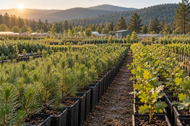
Forest nursery establishment reports
The soil and water conditions, access and suitability for seedling production of a proposed forest nursery site are assessed. Intended production types and the site's basic resources are considered together to explain establishment needs and potential limitations. Before detailed facility and implementation projects are prepared, the establishment report provides a technical assessment supporting site selection and the nursery's overall production approach.
View this service →Forest nursery facility designs
The forest nursery's production areas, water distribution, access layout and necessary support units are planned in relation to one another. The layout is developed with regard to the intended production method and the site's physical conditions. Drawings and technical explanations show how the nursery is to be established, providing a defined arrangement for the physical infrastructure needed for production.
View this service →Forest nursery implementation projects
Species, methods, space and tending requirements for production work in the forest nursery are detailed. The arrangement of production sections, site preparation, seedling cultivation and tending operations are planned in coordination. Drawings and technical explanations show the work to be carried out on site, guiding the implementation of the nursery's establishment and production objectives.
View this service →Revisions to Private Forest Nursery Implementation Projects
The nursery's existing implementation project is compared with current production targets and site layout conditions. Changes in production sections, irrigation arrangements, working areas or capacity requirements are assessed from a technical perspective. Unlike a project for establishing a new nursery, the revised project identifies adjustments to the existing design and records the updated production layout in maps and explanations.
View this service →Private Forest Nursery Implementation Projects
Site conditions, water requirements, seedling characteristics and production targets are assessed together for the proposed nursery. Production plots, irrigation arrangements, working areas and the overall site layout are designed as a coherent technical whole. The implementation project sets out the nursery's establishment and production arrangements, with drawings and explanations that form a basis for planning site preparation and facility works.
View this service →Authorised Professional Advisory Services for Private Forest Nurseries
Technical aspects of nursery production, including species selection, cultivation methods, tending and health monitoring, are considered within professional advisory services. Regular technical guidance is based on the operation's current practices and needs, with the aim of grounding production decisions in concrete field data. The resulting assessments and recommendations support monitoring of the nursery's production arrangements and planning of necessary improvements.
View this service →Private Forest Nursery Management
Sowing, planting, irrigation, tending and seedling lifting are planned to work together in line with the nursery's production targets. The use of production sections, seedling development and day-to-day technical needs are monitored to identify necessary adjustments. Nursery management addresses broader operational needs than the preparation of a single project and supports orderly production records and work schedules.
View this service →
Post-control condition assessment report for state and private forests
Following measures to control harmful organisms, the condition of trees, signs of damage and observable results of the treatment are examined. Where pre-treatment data are available, comparisons identify ongoing issues and monitoring needs; a condition assessment report records the findings and subsequent technical recommendations. This work documents the assessment after treatment.
View this service →Forest pest survey report for state and private forests
The forest site is surveyed for locations showing pest symptoms, affected tree species and the distribution of damage. Field observations are compiled for those seeking to understand current conditions and identify priority areas for investigation before deciding on control measures. A survey report explains the observed symptoms, their extent and any further investigations considered necessary.
View this service →Technical pest control project for state and private forests
A control approach is planned by assessing the harmful organism's impact and distribution, the affected forest structure and site conditions. A technical control project is prepared for those who need to define the treatment method, work areas and monitoring steps. Together with field data, the project explains how implementation will proceed and which observations will be used to track its results.
View this service →Harmful organism notification report for state and private forests
The location, date, affected species and clear signs of damage associated with a harmful organism observed in the forest are systematically recorded. A notification report provides a clear technical record for the relevant assessment process. By presenting the occurrence as observed on site and available information on its extent, the report provides initial data for identification, monitoring or control planning.
View this service →Pest identification sample record for state and private forests
The origin and collection conditions of a sample taken for identification, host plant information and observed symptoms are recorded. Where the field context needs to accompany the sample during examination, an identification sample record links the specimen to the observations. The record identifies the sample and provides supporting technical information without replacing the identification result.
View this service →Technical Pest Control Implementation in Private Forest Nurseries
Control work is carried out with consideration for the identified pest problem, affected production sections and the seedlings' stage of development. The technical control approach covers implementation suited to site conditions and monitoring of the results. This service focuses on field implementation rather than project preparation; actions and observations are recorded to provide information for subsequent monitoring.
View this service →Health Screening and Health Assessment Reports for Private Forest Nurseries
Seedling health is assessed by observing leaves, stems, roots and overall development across production sections. Signs of harmful organisms and problems potentially associated with growing conditions are considered alongside the screening findings. The health assessment report records affected sections, observations and the technical assessment, helping identify the need for control measures or further investigation.
View this service →Technical Pest Control Projects for Private Forest Nurseries
Production sections where harmful organisms occur, the seedlings they affect and the spread of the problem are examined. Control methods, application timing and monitoring arrangements are planned in conjunction with the nursery's production conditions. The technical pest control project explains how the problem identified through health screening will be addressed and guides fieldwork in terms of scope, implementation and monitoring principles.
View this service →Technical Pest Control Projects
The affected tree or plant community, the spread of the problem and site conditions are examined to identify the need for pest control. Appropriate intervention methods, application areas and arrangements for monitoring results are planned within a technical framework. The project sets out methods and monitoring principles for the relevant site, beyond nursery settings, and provides a planning deliverable separate from implementation itself.
View this service →Health Screening Reports for Harmful Organisms
Tree and plant health, signs of harmful organisms and the distribution of their effects are assessed using observations and appropriate field records. Identified problems, their spread and their current condition are organised in a report, with a technical assessment of the need for intervention. The health screening report helps define the problem before a control project and establish a baseline for comparison during subsequent monitoring.
View this service →
Consultancy under Articles 16, 17, 18 and 52 of Law No. 6831
Project or site requirements under Articles 16, 17, 18 and 52 of Law No. 6831 are technically assessed using available information. Guidance on dossier preparation, site investigation and organisation of project data is provided for those seeking to understand which forestry work is needed. The consultancy produces technical assessments and work recommendations tailored to the requirement.
View this service →Responsible technical management for forestry operations
Field work, implementation records and work requirements that need to be tracked in the technical delivery of forest-related operations or activities are assessed. Consistency between planned operations and field implementation is monitored within the scope of the responsible management service. The service covers organising technical work records, reporting findings and preparing recommendations for corrective work where considered necessary.
View this service →Forestry consultancy tailored to project needs
Questions relating to a site, investment or forestry project are assessed using available information, site conditions and the intended work. The consultancy clarifies which technical investigations are needed, how the available options differ and what the next steps involve. A tailored technical opinion, assessment note or work roadmap helps establish a technical basis for decision-making.
View this service →Engineering services for forestry product exports
Technical specifications, product descriptions and available engineering information concerning forestry product exports are reviewed according to the requested scope of work. Relevant records are assessed to describe the product accurately and present technical information consistently. A product assessment, report or technical file is prepared to address the engineering needs of the export process.
View this service →Engineering services for forestry product imports
Descriptions, technical specifications and available information or documents for forestry products intended for import are reviewed. The assessment helps explain the product's relationship to its intended use and supports accurate interpretation of technical information. Depending on the import, an engineering opinion, product assessment or technical file presents the explanations needed for decisions and applications in an organised form.
View this service →Technical Reports
Existing information, field observations and necessary measurements are assessed to address a specific forestry question or site need. The purpose and scope of the investigation are defined at the outset, and findings are organised with their technical reasoning. The report provides a written deliverable that clearly presents the current situation, assessment results and recommendations considered appropriate to the subject.
View this service →